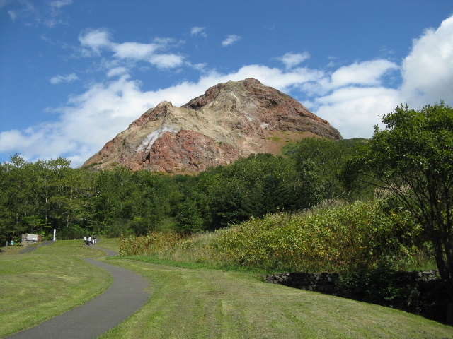
昭和新山(標高398m)

 アクセス
 洞爺湖の南湖畔に延びる道道2号線(洞爺湖登別線)から道道703号線を南下すると、昭和新山の前に有料駐車場(普通車410円)がある。
 国土地理院の地形図   周辺地図
=写真をクリックすると大きなサイズになります=
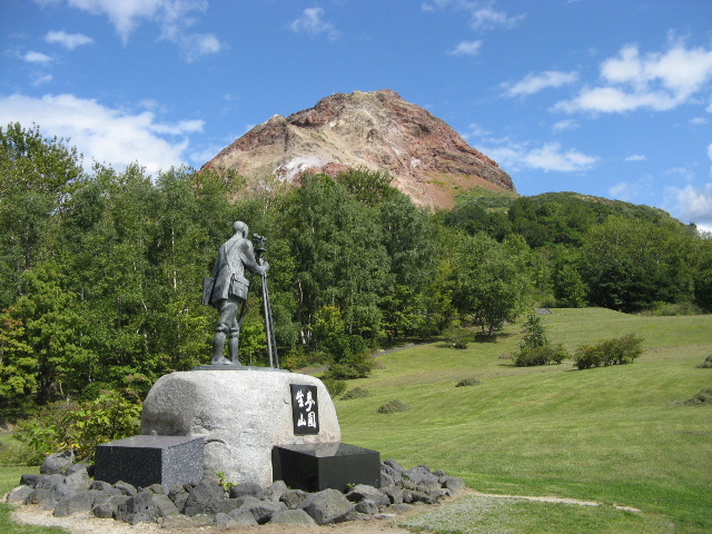
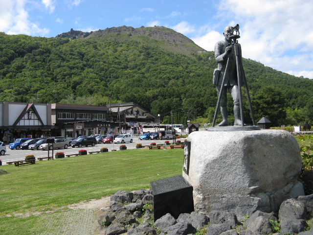
 有珠山ロープウェイから昭和新山に向かうと、小高い公園の一角に三松氏が観測をしている格好の銅像があった。足元には「麦圃生山」と彫られたプレートが埋め込まれ、日本語、英語、中国語、韓国語で彫られた碑文があった。
昭和新山 三松氏の銅像 碑文 正面から
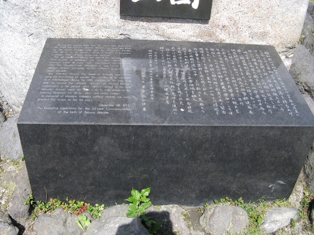
 During the period from Dec 28,1943 until September
20,1945,the volcano Showa Shinzan was born and lifted
up the area's farming field and the hamlet of Fukoba
with all of its 12 houses. After 4.months of eruptions,
a Unique form of lava dome was created.
 This all happened during the end of the Second Warld
War a time of turbulence and confusion. Since Japan's
scientisits were all busy with war reated activities, and
since tis disaster was classifield as 'top secret' by the
military, proper surveying of the volcano's progress did'nt
seem possible.
 But, Mimatsu Masao, the head of Sobetsu post office,
using the knowledge he gained by working as an assistant
to a volcanologist during the 1910 eruphon of Mt.Usu. was
able to record the voicanic activity of Showa Shinzan.
Furthermore, in the period after Japan's defeat in the war,
Mimatsu Masao used his own funds to help preserve the
precious landmrk for all to view and study today.
l In memorial of MImatsu Masao's selfless efforts, we have
erectded this statue to tell his story.
                   December 28, 1993
 The Executive Committee for the 50-year Commemoration
         of the birth of Showa Shinzan
 昭和新山は昭和十八年暮れから二十年九月末に
かけのどかな麦畑とフカバ部落を持ち上げ
四ケ月の爆発期を経て熔岩塔推上という
珍しい現象を伴ってこの地に誕生した
 時は第二次世界大戦末期の混乱下にあり
厳しい報道規制が敷かれ火山学者の十分な
調査研究さえままならない頃であった。
 この様な中にあって地元の壮瞥郵便局長
三松正夫
(一八八八〜一九七七)は明治四十三年の
有珠山噴火体験時に受けた学者の教えを
想起し この火山活動を歴史の空白にしては
ならないと 冷静な観察眼で創意工夫と努力
想像を絶する苦難を重ねて火山誕生の経過を
語る貴重な資料を世に残された
 更に敗戦の混乱の中 この新山を荒廃から
護るため私財を投じて主要地域を購入
万民の宝として保護に死力を尽くされ今日迄
我々に自然のあるがままの姿を残された
 翁の私利私欲を越えた行動の意味を後世に
語りつぐためにこの像をここに建立する
  平成五年十二月二十八日
 昭和新山生成五十周年記念事業実行委員会
       壮瞥町長 菅原 一謹 書
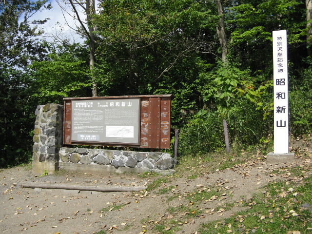
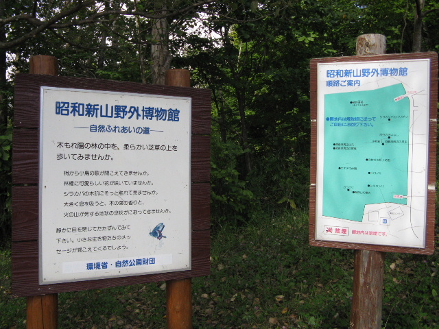
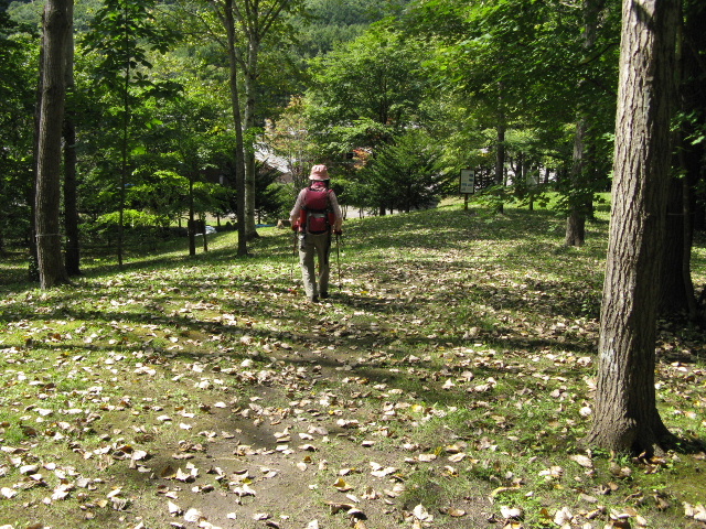
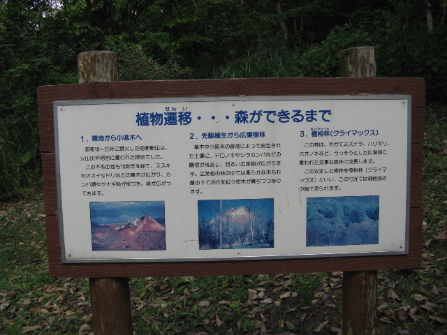
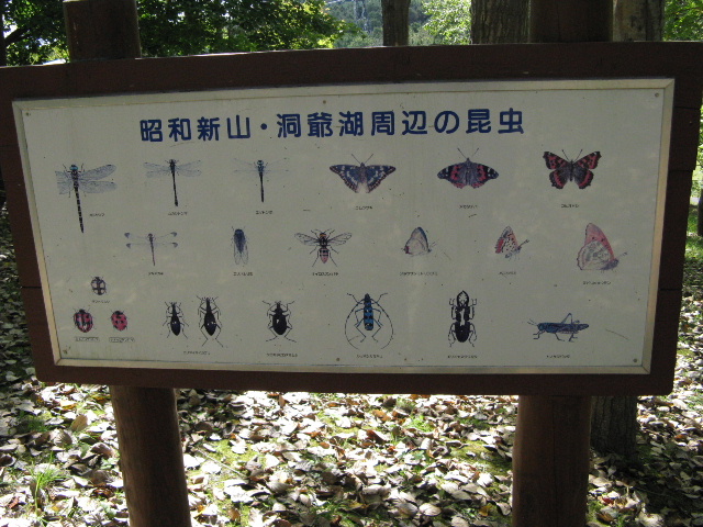
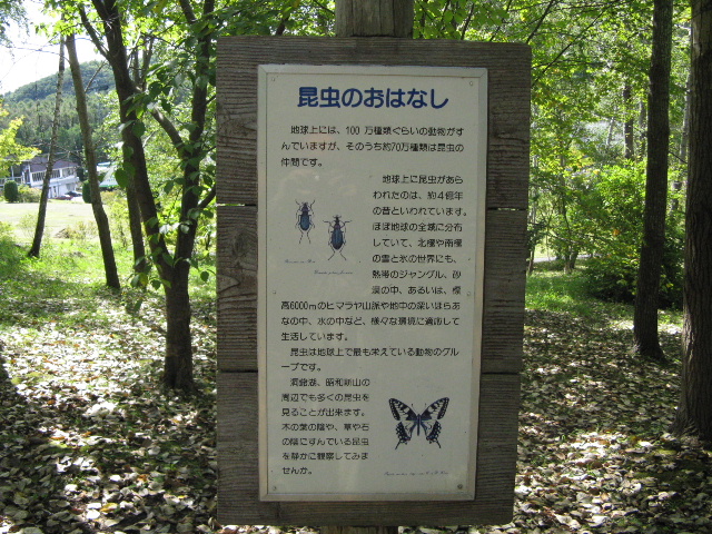
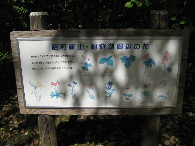
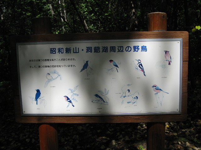
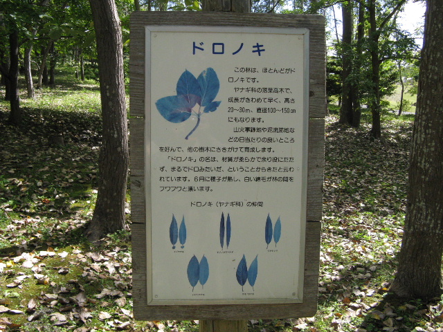
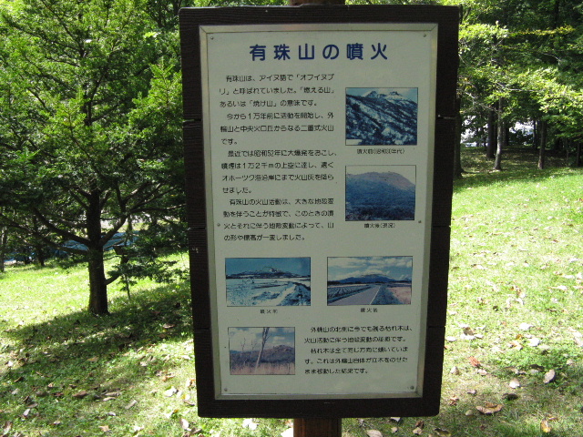
 銅像を見て、昭和新山に近づいて行くと、登山道は閉鎖されていた。昔は、結構上まで行けたと思うが残念だった。一番上の広場には、特別天然記念物(昭和三十二年六月十九日指定)の標柱と解説板があった。書かれている内容は、銅像の碑文よりも詳しく書かれていた。
 帰りは野外博物館(小さな遊歩道)があり、入って見ると、鳥、木、花、火山等の解説板がたっていた。順次、見てまわる。
上の広場 野外博物館入口 博物館の中 解説板
支笏洞爺国立公園 特   別  昭 和 新 山 
特 別 保 護 地 域 天然記念物
昭和新山の生い立ち
 目前にそびえる昭和新山は、私達に大自然のいとなみの不思議を物語ってくれます。
 今あなたの立っているこの一部は、かってはのどかな麦畑でしたが、突然火山活動の舞台と
なりました。昭和18年12月28日に激しい地震が始まり、多い時には身体に感じるものだけでも
1日200回を越え、翌19年4月頃には元の地面から50mも隆起しました。
 さらに昭和19年6月23日、盛り上がった畑に噴火が始まり、7個の噴火口をつくりながら、
4ケ月も爆発を繰り返しました。その間も、田畑、民家(フカバ部落)、鉄道共々隆起が続き
標高300mの台地(屋根山)をつくりました。11月になって、噴火群の中央から地中で固まっ
た熔岩が堆し上り始め、翌20年9月末に標高407mに達し、ようやくその活動を休止しました。
 今なお噴気を上げるピラミッド型レンガ色の部分が熔岩塔で、このタイプの火山をペロニー
テ型といい、世界的にも珍しい形式です。

ミマツダイヤグラム
 昭和新山が誕生した頃は第二次世界大戦の末期で、軍部はこれを機密事項にし、火山学者も
十分な調査・観測ができませんでした。ところが地元の郵便局長三松正夫(1888〜1977)さんは、
この火山誕生の詳細な観察記録を残しました。それからこの珍しい火山活動を分析するのに貴
重な学術資料とされ、その一つが「ミマツダイヤグラム」です。
 三松さんが残した資料は、現在、山麓の「三松正夫記念館」(昭和新山資料館)で保存、公開
されています。

                 環境省・北海道・壮瞥町
                 (財)自然公園財団
THE HISTORY O MT.SHOWA SHINZAN
Mt.Shouwa shinzan. you can ahead, tells story of Nature's Wonder.
A series of violent earthquakes, somtimes over 200 large tremors in one day. occured from December,1943.until April.
1944. The result was the transformation of wheat field into a raised plateau, 50 meters high.
The first volcanic eruptions started on June 23,1944,from one crater and continued for four months,destroyting the wheat
fields,houses, and railroads, As a result, this area turned into the egg-shaped plateau. 300 metera above sea level. And
seven craters were founded. In November, 1994. lava started rising from the central crater and continued until September.
1945. At last,the altitude was 407 meters.
But smoke is still spouting from the reddish-brown peak, which instantly recognizzble by its unque pyramid shape. This
volcanic type is called "Belonite"and is rare even in the world.


MIMATU DIAGRAM
Because Mt.Showa Shinzan was born at the end of the Second World War, the military kept this fact a secret. So satisfactory
investigations coudn't be done. Under this situation. Mr. Masao Mimatzu(1888-1977), the postmaster of the district,
investigated the development of Mt. Shouwa Shinzan in detail. His records are valuable scientific data to analyze these unique
volcanic activities. One of his records is called "Mimatsu Diagram"
You can see Mimatsu's recorda and data in Mimatzu Masao Memorial Hall at the base of the mountain.

散歩路もくじ3へ   次昭和新山鉄橋遺構へ  北の探歩訪へ

 二人の散歩路記録 (遊びの時間含む)
 2009.9.9