| Mt.Asahidake(旭岳2,290.9m) =Taisetsuzan Volcanic Group= |
|
Guide The Taisetsuzan(大雪山) Volcanic Group is also called Daisetsuzan. Taisetsuzan has been designated as a national park.The National Park is located in central Hokkaido. There is Mt.Asahidake of the highest peak in Hokkaido. Large caldera named ohachidaira(御鉢平) is formed in the center of Taisetsuzan. The main peaks surrounding caldera, are as follows. Mt.Asahidake(旭岳)2,291m Mt.Kurodake(黒岳)1,984m Mt.Akadake(赤岳)2,078m Mt.midoridake(緑岳)2,019m Mt.hakuundake(白雲岳)2,230m Map of GSI GPS track Map of Google |
| The corse takes about 2hours and 20mins to hike up to the summit, and 1hour and 10mins for the return tirp. |
| Riding on the gondola of st.sanroku(山麓1,100m), go up to the st.Sugatami(姿見1,600m). |
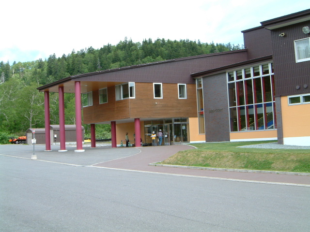 |
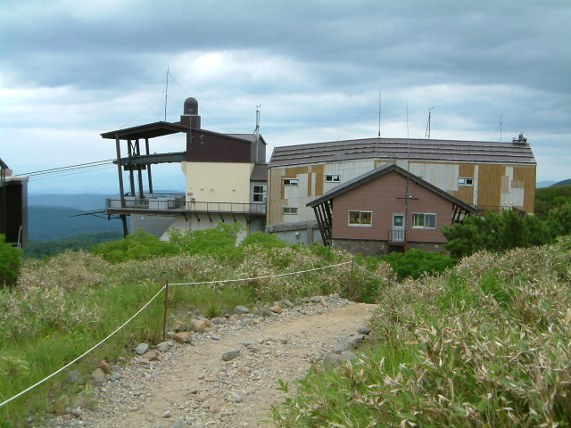
| ropeway station sanroku at foot of mountain (山麓駅) |
 |
| view of Mt.Asahidake |
| There is a boardwalk around pond Sugataminoike, a beautiful swamp is dotted. |
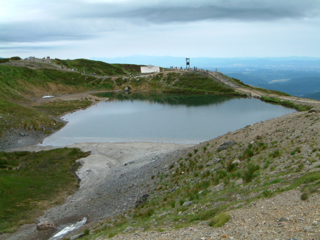 |
| Pond named Sugataminoike (姿見の池) |
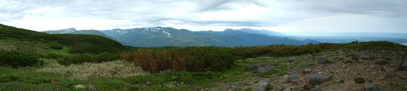 |
| Tokachi mountain range |
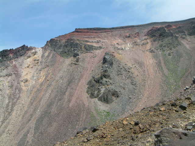 |
| view of Red wall |
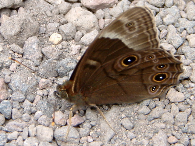 |
| Minois Dryad (ジャノメチョウ:janomecho) |
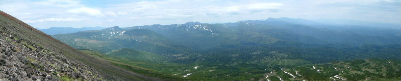 |
| Mt.chuubetudake(忠別岳)MT.tomurausiyama(トムラウシ山) Tokachi mountain range |
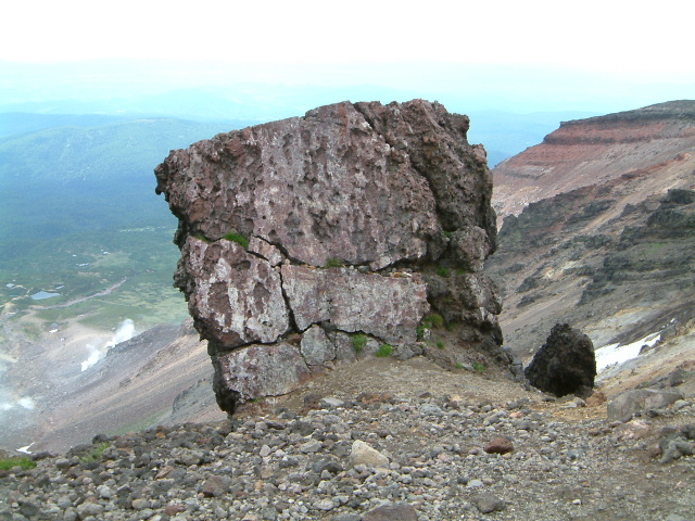 |
| Rock named kinkoiwa;Form such as safe (金庫岩:kinkoiwa) |
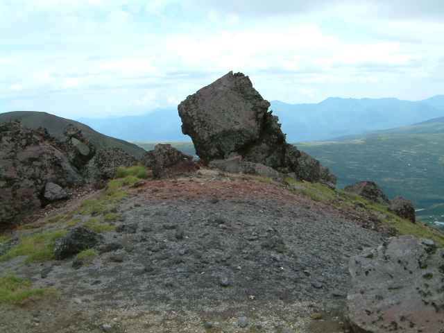 |
| Rock named nisekinkoiwa;Form such as kinkoiwa (ニセ金庫岩:nisekinkoiwa) |
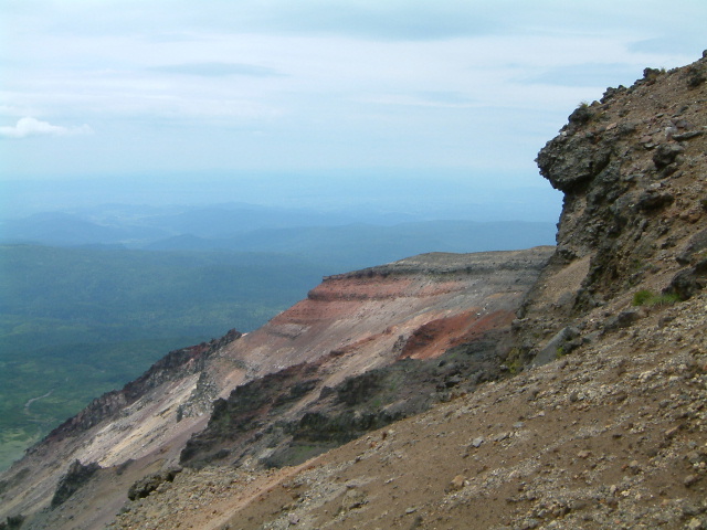 |
| view of Red wall |
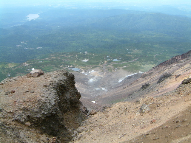 |
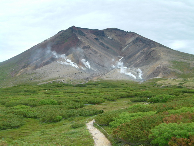
| view of Crater |
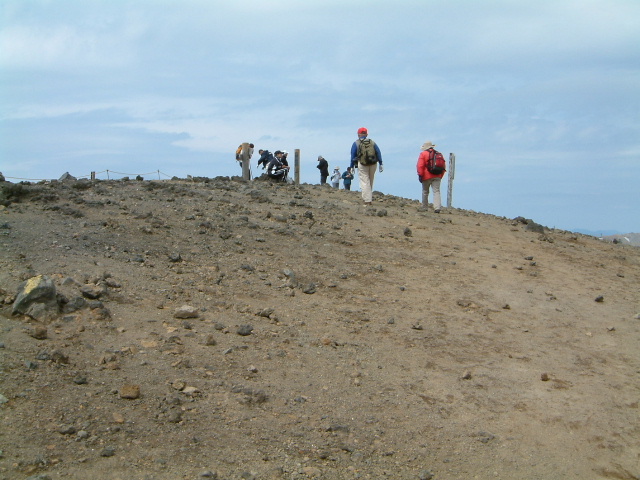 |
| Top of Mt.Asahidake |
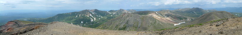 |
| Large caldera named ohachidaira (御鉢平:ohachidaira) |
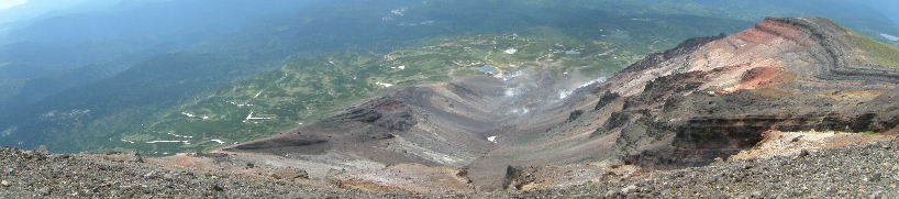 |
| Inside the crater |
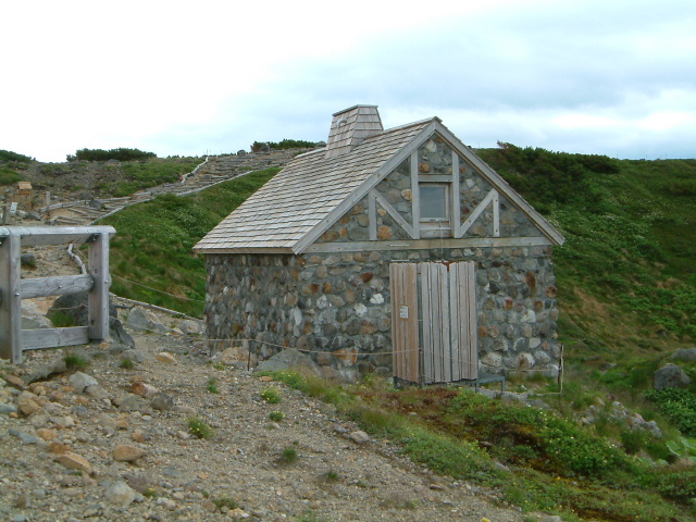 |
| Hutte asahidake-isimuro (旭岳石室) |
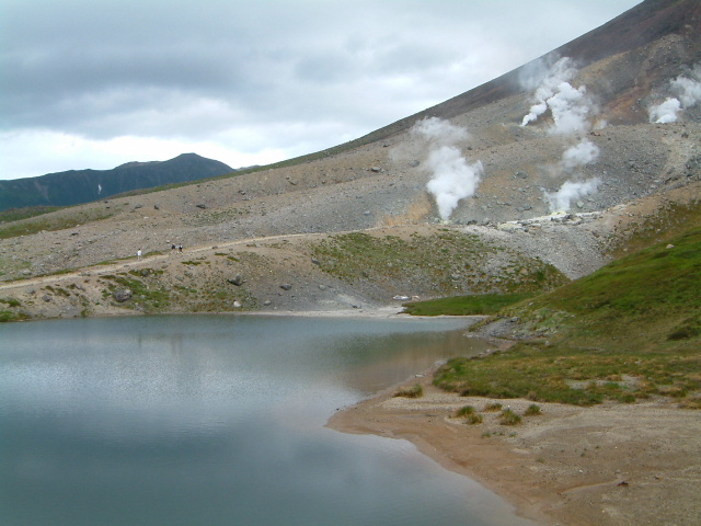 |
| Pond named Sugataminoike (姿見の池) |
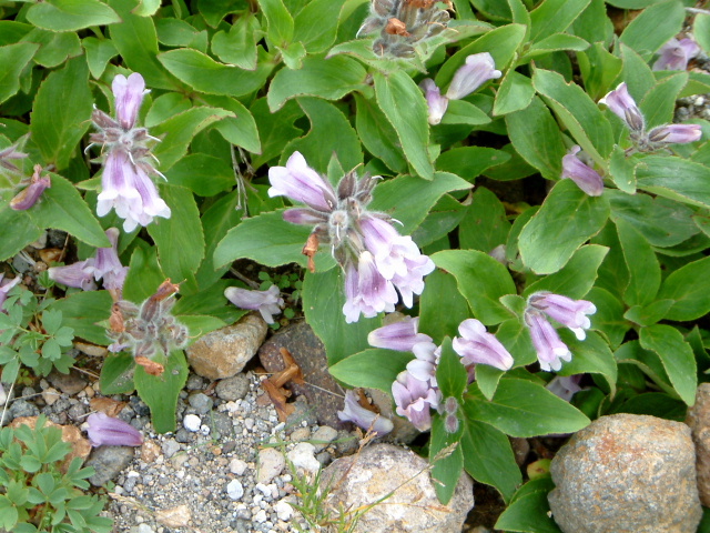 |
| Psntstemon frutescens (イワブクロ:iwabukuro) |
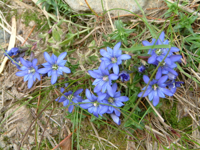 |
| Gentiana nipponica (フデリンドウ:fuderindo) |
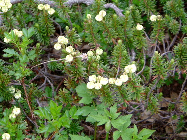 |
| Phyllodoce aleutica (アオノツガザクラ:aonotugazakura) |
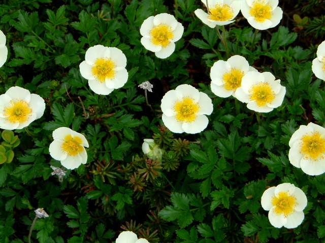 |
| Geum pentapetalum (チングルマ:chinguruma) |
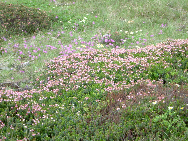 |
| Phyllodoce caerulea and Primula cuneifolia (エゾツガザクラ:ezotugazakura) |
 |
| station sugatami of the ropeway (姿見駅) |
|
INDEX Record of hiking |